Saturday 29 July 2017

Day 3: Val d'Isere to Cesna Torinese (Italy) 79.7 miles, 11,388 ft of ascent

The Hotel Les Seracs did us proud - not only did they wash and dry our kit, they got out hair dryers to dry our shoes, let Phil use their computer and provided us with an excellent dinner and breakfast. We left at 8.28 with renewed spirits to tackle the rest of the Col de L'Iseran which was only due to open on this day but had in fact opened a week early.

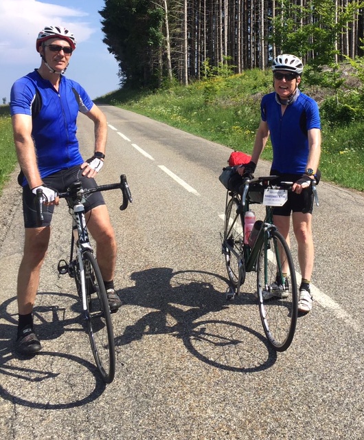
Val d'Isere is lined with modern apartments for skiers and more were being built and rammed in. The road through the town was at least wide and relatively flat. Once out of the town and after a couple of kilometres of straight road a sharp hairpin is reached and the climb begins in earnest. This was a great climb and by now the beauty was apparent. Verdant pastures bloomed with wild flowers and six months of snow was melting with water cascading off the rocks.The scenery is huge and expansive with long range views and the geological and glacial formations made it reminiscent of a geography field trip. The only disappointment were the large number of motorbikes and a few sports cars roaring up to the top.Towards the top there were banks of snow on one side of the road and the altitude began to be felt. At 2,770 metres it is the highest paved mountain pass in Europe and the summit felt more Himalayan than Alpine. For the first time on the trip it felt cold and I was glad of my gillet and jacket.

The summit cafe was shut so we veered off the main road to a skiing cafe called La Cascade where there were a large number of people skiing and snowboarding on the slopes above it. In order to get to the cafe we had to cross a small snow field in our cleats and carry our bikes which must have seemed somewhat incongruous to the onlookers. We got our cards stamped and chatted with another cyclist from the UK, even older than me, who had ridden up the other side this morning.

Col de L'Iseran: Plenty of snow still around at the highest paved col in Europe

The route over the col has existed for hundreds of years as a mule pass and became an official road following a presidential decree in the 1920s with 600 workers toiling to make the road which was opened in 1937. But cyclists were scaling this before the road was completed. The local bishop decided to accompany the roadworks with the construction of a chapel – France’s highest – which was baptised Notre Dame de Toute Prudence, a useful tip for descending the other side.

The descent down to Bonneval-sur-Arc needed care with the huge number of motor bikes ascending the other way. The next village up the valley, Oratoire de la St Trinite, was reminiscent of a Hobbit village from afar but the road turned south westwards along the bottom of the L'Arc Valley so we didn't get a chance to see it close up. Twelve miles of easy valley riding took us to the ski resort of Lanslevillard where we stopped for an early lunch.


Waterfall on the descent of the Col de L'Iseran

L'Arc Valley

The road up the Col du Mont-Cenis was built by Napoleon between 1803 and 1810 and you can tell its a military road with five hairpin bends equally distributed along the route from base to summit and an even gradient of 8%. Prior to that the pass was well used by pilgrims in the middle ages on their way to Rome. It marks the border between France and Italy and has been used both in the Tour and the Giro d'Italia. For once I led up the the first few hairpins and was passed by Chris but Phil didn't pass me until near the summit - maybe an early sign that something wasn't quite right?


Col du Mont-Cenis

We stopped at the top at a cafe for drinks in the shade and to get our control cards stamped and any thoughts of adding the the infamous and optional Colle delle Finestre later that afternoon were squashed.. The road then traversed the picturesque Lac de Mont -Cenis with several ascents and descents before the long and enjoyable descent on a smooth tarmac surface to Susa in Italy.

Above and Below: Lac de Mont-Cenis


By the time the Roman town of Susa was reached the temperature had increased by at least 10 degrees Centigrade to the mid 30s and it was like entering into an oven. I didn't spot Chris and Phil who had stopped in the town's square and I continued out on the road to Oulx. Chris caught me up on one of the long drags out of the town and informed me that Phil had had enough and was going to try and get a train to Oulx - clearly emulating several riders in the 1904 Tour.

I was pretty shattered in the heat but still had some mental strength and somehow was able to get onto Chris back wheel and we made steady but slow progress along the Ripatio valley and the final climb to our evening's destination at Cesana Torinese (some 20 miles from Susa). We stopped in Oulx for a drink and Phil texted us to say that he had decided to get a taxi from Oulx to Cesana Torinese where we met him at our hotel (nearly 11 hours since setting out that morning).
Day 3 Route

Italian starter

Wednesday 26 July 2017

Day 2: Megeve to Val d'Isere 62.6 Miles, 10,321ft of ascent

We decided to skip breakfast at the hotel and find something en-route as we wanted an early start and couldn't hang around until they served it at 8.00am. We were away by 7.40 am and the air was noticeably clearer with some rain overnight. It felt like being another warm day.

Early morning in Megeve

Looking across to the Skiing Pistes of Megeve
                       
We found a cafe serving breakfast at the village of Praz-sur-Arly four miles down the road from Megeve. With our quota of Caffeine we were ready to face the day.

The first climb was soon upon us- the Col des Saises (1650metres) which started at the turn off on the main road between Flumet and Megeve. It is an attractive climb alternating between Forest and Alpine pastures with great views across the Valley. The gradient alternated between  some sections at 8% and 9% and others at 4% to 5% with a 1.5 Kilometre descent after the pretty village of Arcaniere

Love the Savoie Kilometre markers up the Col des Saises -1km to go -always a welcome sign!
The summit was something of a disappointment, just a flattening out of the road as it goes through a semi-deserted ski resort with a hive of new construction activity. Chris waited for me at the top whilst Phil continued on the descent to sus-out a coffee stop.

The uninspiring Col des Saises
                             
But much more inspiring views to the South
                                       
He hailed Chris and I down at the junction of the descent and the main road to Albertville at the Hotel la Cascade where we enjoyed our Cappuccinos sitting outside in the sun. We then had a short flat section to the ski resort of  Beaufort, famous for its lovely cheese. As I approached the town I realised I had visited it before back in 2012 when as a family we had stayed in the area on my failed first attempt at completing the Etape du Tour.

It was now getting warm and we stopped at the small supermarket near the attractive church to buy fruit.

The picturesque Saint-Maxime Church in Beaufort
                                 
The Raid doesn't take the classic route up the Cormet-de-Roseland (1967 metres)  via the Col du Meraillet but instead takes a quieter but much harder route via the village of Areches (another control point for a stamp this time from the Tourist office) and the Col du Pre (1703 metres). The Beaufort Tourist office describes it as Mythic.I'm not sure about the name but it is certainly steep with the second last kilometre averaging 10.7%. It was very hard work in the heat of the day with lots of hairpins. Chris powered his way to the top and was a good 15 minutes ahead of Phil and almost 20 minutes ahead of myself.

Col du Pres
                                               
Phil near the Col du Pres
                                             
The route then descends for a couple of kilometres and given it was now lunch time we stopped for an hour at the La Pierra Menta restaurant which judging by it's website does a roaring trade throughout the year. The views of the lake and the surrounding mountains were stunning.

The road then descends to the Lake (Lac de Roseland) and crosses the dam before the final climb of 6 Kilometres and 374 metres of climb kicks in to the Cormet-de-Roseland. The last few kilometres were a little easier as the road climbed to the giant natural amphitheatre surrounded by towering rock faces and snowy peaks.

Lac de Roseland
                                       
The Cormet has often been used by the Tour but I'm glad I hadn't seen the You Tube video of  Johan Bruyneel's descent in 1996 until I returned to the UK. He came off the road, disappeared and almost fell down a cliff. Miraculously his fall was broken by a tree and he was able to climb back up, get on a replacement bike and finish the stage

At 15.10 that would have made a nice end to the day but ahead of us still lay another 25 miles of riding and the climb up to Val d'Isere. Not even knowing about the video I still descended cautiously around the many tight hairpins to Bourg St Maurice. The clouds were thickening and the air was getting very heavy and you knew we would be in for a spectacular Alpine thunderstorm later in the day. We made our fourth stop of the day for afternoon Oranginas and a refill of our water bottles.

The climb of the giant Col de L'Iseran starts in Bourg St Maurice. The first bit is a major arterial road with heavy traffic rather than the usual Alpine road. Fortunately the road soon splits with the turning for the Col du Petit St Bernard which leads to Italy and this siphons away some of the traffic. At the junction the first spots of rain were felt.The road starts to rise at the village of Viclaire and then gets serious with some wide hairpins on the way to the ski village of Sainte Foy. The rain became heavier and Phil passed me on one of the hairpins. Suddenly the storm also got serious- sheet lightning all around and the rain forming a torrent on either side of the camber and we were almost enveloped in darkness despite it being late afternoon/early evening. I decided to take cover in a bus stop in a very large lay-by and refused a lift offered by a driver parked at its entrance. For nearly half an hour I waited for it to clear with water rising up around the platform I was standing on and the rain of biblical proportions. I felt it was dangerous to ride in the lightning which was so close given the small gaps to the claps of thunder although Chris and Phil ploughed on through it.

Eventually another French driver spotted me and slowed and gestured to ask whether I wanted a lift. This time I didn't refuse. A keen cyclist himself we chucked my bike into the back of his van and I jumped into the passenger seat, water forming a puddle in his mat well. A couple of miles up the road I spotted Phil slogging away up another hairpin. I wound down the window and asked whether he wanted a lift. I will not repeat what he said to me but suffice to say he too readily took up the offer. We took some time to work out how to get both bikes and Phil into the back of the van but by taking off our front wheels we eventually solved the puzzle. 

The road up to La Reculaz, our night's stop, went through a couple of tunnels, one of which was unlit but it wasn't until we reached the Hotel Les Seracs that we caught up with Chris. He had heroically ridden through the storm and used his mobile phone as a torch through the unlit tunnel. 

The proprietor welcomed us in, gave us a basket for all our wet clothes and we were soon showered, exhausted but sipping beer and enjoying a great evening meal.

Day 2 Route

Sunday 23 July 2017

Day 1: Thonon-les-Bains to Megeve 67.6 miles 10,313 ft of climb (as recorded by Strava).

Once again, our first hotel, this time an Ibiz, was ideal for our purposes with plenty of space to spread ourselves out and assemble our bikes and faff with our kit much to the amusement of the other residents. Phil's bike was still in one piece despite the hammering his bike box had taken the previous day from the baggage handlers. Breakfast was taken on the terrace and it was already clear that a hot day was in store.

After the customary "start of tour" posed photos overlooking Lake Geneva we started our various GPS devices at just after 9.30 am and battled with Thonon's one way system as we searched for the right road out of the town.
Posed start of Tour Photo in Thonon -Les -Bains overlooking Lake Geneva
Despite all of Phil's Vitriol of Chris's Garmin in the Pyrenees last year he had gone out and bought a top of the range device for this year's tour. And his Garmin almost caused us to be late for our flight from Bristol as at the last minute we helped Phil transfer my ride GPS routes from his Apple laptop onto his device before setting out for the airport. Mind you at least it meant that for the first year Phil knew where he was going and he didn't have to rely on my list of villages, towns and road numbers each morning.

The area of flat hinterland around Lake Geneva is small and it wasn't long before we were sweating up though woodland to climb our first col, the Col de Moises (1121 metres) which with an average ascent of 6.6% and the steepest part at 8% just below the summit required plenty of work to start the tour. The descent down to the village of Harbere-Roche provided a welcome stop  for a coffee and to refill our water bottles as this was the first checkpoint  of the Raid at the local boulangerie.
Col de Moises
Next up were the minor cols of the Col de Terramont (1094 metre) and the Col de Jambaz (1027 metres) before a sweeping descent down to Megevette. Just after the turn off to the Col de la Ramaz I spotted a deer in a field and then I let out a whoop of delight as in front of me was a fabulous view across to Mont Blanc with it's snow covered whale-back summit clear of cloud -a mountain I had climbed nearly 11 years ago.

The first few kilometres of the Col de la Ramaz (1608 metres) through the chalets and farms  are at 8%, then the road eases of to 2% for over a km. After a further 3km of switchbacks through the forest, the serious stuff begins. The road is now cut into the plunging hill side above the Gorges du Foron, and the gradient alternates 9%, 7%, 9% and finally 10% at the steepest section through a tunnel. The ever-changing gradient means it is hard to settle into a rhythm.I was glad of the shade under the avalanche shelters and in the tunnel: the mountainside here is south-facing and we were in the full blast of the sun. The road finally levels out to a more reasonable 5% as it reaches and curves around the col de la Ramaz and the Sommand plateau for another 3 km.


Lunch stop near the top of the Col de la Ramaz
The Col de la Ramaz summit
The Col de la Ramaz (the highest point of our first day) has only been used 4 times so far by the Tour de France, in 1981, 2003, 2010 and 2016.In 2003, the Col de la Ramaz was the principle difficulty of the 7th stage, from Lyon to Morzine/Avoriaz. The French favourite Richard Virenque delighted the crowds with a 190km breakaway, winning both the stage and the yellow jersey. This was in spite of Armstrong’s US Postal in hot pursuit! Virenque paid for his efforts the next day, losing the yellow jersey and over 7 minutes to Armstrong on the climb to Alpe d’Huez.

By the time we reached the summit at 13.40 we were gasping for liquid and food. A superb spaghetti- bolognese hit the spot  and despite some cramping I felt energised to continue. At the ski station of Praz-de-Lyz there was only one shop open for our precious Alpine Raid stamp but the owner gave us each a free gift of a head scarf which was to prove invaluable as the week wore on. 


Views across to Mont Blanc (now shrouded in cloud)
There were warnings that the next section of road was closed due to road works but given that the alternative diversion was a considerable way round we continued on the descent. Eventually the barriers across the road prevented us going any further. We pleaded with the road workers in our broken French to allow us to walk through as there was no way we were going to retrace our steps. Eventually they saw sense and let us through and we enjoyed a traffic  free descent to the D902 which led us down to Taninges. Another ascent to St-Sigismond bypassed Cluses before we hit the l'Arve valley floor. I got on Chris's back wheel and surpisngly we opened a small gap over Phil. 

We should have stopped at Sallanches before the final ascent to Megeve but for some reason Chris kept going and I failed to reign him in (he is so strong). Shortly afterwards Phil texted us clearly somewhat exasperated to find that we hadn't stopped. 

The final slog up to Megeve was very hard work in the evening heat and I had to stop a couple of times to draw breath and drink the tepid fluid from my water bottle. I eventually arrived at Chalet d'Antoine in Megeve  at 18.45 some 15 minutes behind Chris and 20 minutes ahead of  Phil who had sensibly stopped at Sallanches for a cafe stop. The hotel seemed barely open, they weren't serving dinner and had no beer on tap but at least they were happy to wash out our sweaty kit for 7 euros. 

Megeve is a posh ski resort at one time favoured by the French aristocracy and nowadays it is still visited by affluent people as evidenced by the prices of apartments in the estate agents windows. We enjoyed an excellent meal at a local restaurant in the town centre and like most evenings to follow retired to bed early.
Day 1 Route
                  

Saturday 22 July 2017

Arrival In Thonon-Les-Bains

All my previous flights to Geneva had been to undertake Mountaineering trips with my friend Bill and my brother Richard. From Geneva airport we would catch the train up to Leysin in Switzerland to meet our guide, Roger Payne,The last trip had been in 2011 but the year after Roger had been tragically killed in an avalanche on Mont Blanc whilst guiding two clients. So as we descended into Geneva on a barmy evening my thoughts were of Roger and his wife Julie-Ann Clyma and great memories of climbing 4,000 metre peaks in Switzerland, Italy and France.

The airport baggage handlers almost managed to destroy Phil's bike box and his wheels were rammed into the box. We quickly found our transfer driver and were soon speeding our way out of Geneva and into France to an Ibiz hotel in Thonon-les-Bains on the south side of Lake Geneva.

On arrival Phil immediately took on his role of chief food organiser and persuaded the chef to russle up a splendid meal despite our lateness of arrival. Food and Beer were the priorities, our bike assembly could wait until the morning.

Raid Alps 2017

The Raid Alpine (La Randonnée Alpine Léman-Côte D'Azur) is a permanent cycling challenge from Lake Geneva to Antibes on the Mediterranean through the Southern Alps and over some of the most legendary Alpine climbs and the two highest; the Col de l'Iseran and the Cime de la Bonette. It is 712 kms long and crosses 27 cols of which 9 are over 2,000 metres. The total ascent is 18,187 metres (just over twice the height of Everest!).

It is organised by the Cyclos Randonneurs Thononais and by officially registering with the club you get a control card which has to be stamped at set locations along the way (shops, cafes and tourist offices) to prove you have completed the route. There is no time constraints and the route can be done in stages or all in one go.

Chris, Phil and I had survived two epic cycling tours together and we still had an appetite to do another one. Each tour had been just that harder than the previous one and having survived a traverse of the Pyrenees in 2016 our thoughts inevitably turned to the Alps. The second part of the Raid Alpine from Lake Geneva to Trieste was dismissed as requiring too much time to complete and so we settled on a 6 day tour with the aim of conquering the first part of the Raid Alpine.

How ever hard you train it's impossible to replicate the climbing conditions found on the continent. Our longest local climb on the Mendips, Cheddar Gorge, takes about 25 minutes but in the Alps you could easily be climbing for well over 2.5 hours. So despite putting in the miles and the climbs it's still a shock to the system when the first Alpine Climb kicks in.